There are many great day hikes in Iceland. One of the best travel tips for Iceland is to explore the true beauty of the country by walking through it.
Park the car and head out on one of this beautiful Nordic country’s many hikes.
You don’t have to be an experienced hiker or a lover of hiking with a packed backpack, sleeping in the wild, and eating from a portable cooker. Here are 7 tips for the best day hikes in Iceland that almost anyone can do.
Table of Contents
ToggleWestman Islands (Vestmannaeyjar)
There are few places like the Westman Islands. You’ll find enough activities in a small area for two days, whether searching for puffins, learning volcanic history, or going on hikes.
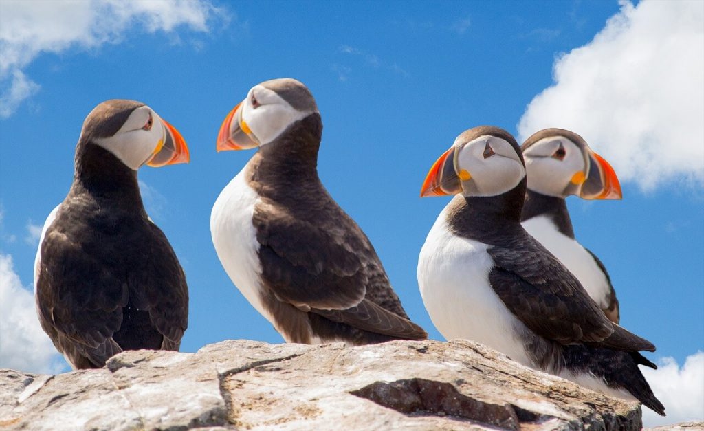
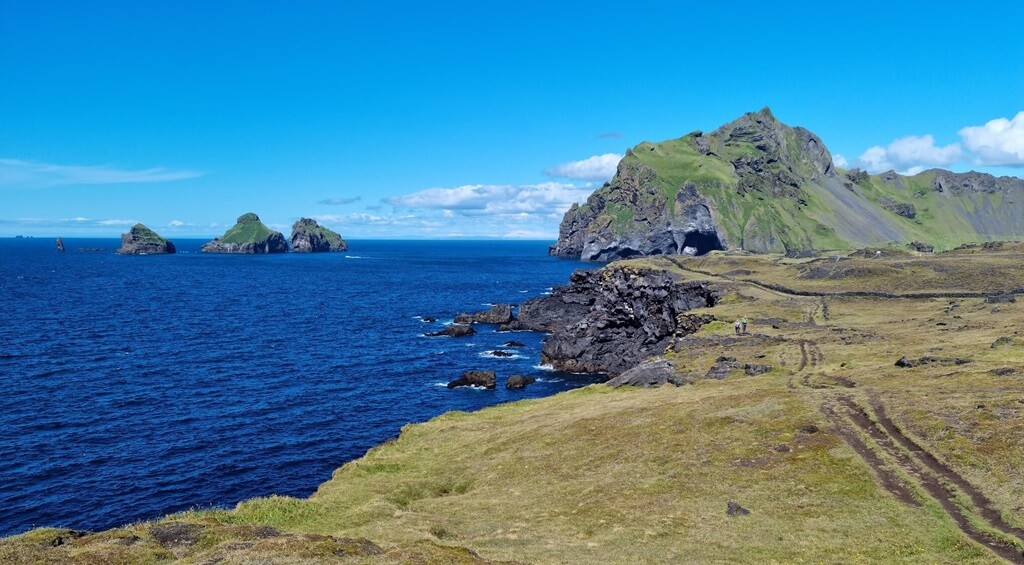
The main island of the Westman Islands, Heimaey, offers it all. Explore Helgafell and Eldfell volcanos, or if you’re feeling more adventurous, get ready for some real hiking.
Why go
Even though the Westman Islands isn’t very far away from the heavily visited southern part of Iceland, many tourists don’t go there, and it’s a shame because it’s a beautiful place.
If you like walking, don’t take a car. Explore the main island by foot. There are also a few favourite hiking spots that will challenge you or bring you to some hidden gems of that archipelago.
How to get there
To get to Heimaey, you need to get a ferry, which is available for both cars and people. It’ll take you on a scenic journey. The ferry leaves from Landeyjahöfn, a 2-hour drive from Reykjavík to the south of Iceland.
Check out the best places to stay in Reykjavik.
Best hikes in Westman Islands
- You can do a so-called 7-peak walk that will take you to all the most important places, including the volcanoes, puffin spots, and mountains with more difficult parts of trails (such as Dalfjall or Herjólfsdalur). If it’s too much for you, you can do it separately or divide it into more days. It takes around 4 to 5 hours to finish it.
- Looking for some privacy? Go to the secret beach, Stafsnes. It’s located on the other side of the mountain, and you’ll probably be alone there. After that, you can continue going to the peak of Blátindur. And if you still don’t have enough, continue on the ridge up to Moldi.
- Want a challenging but short hike? We’ve got one! This 2-km trail will take you to the top of Heimaklettur. It has some difficult parts (climbing on ladders, for instance), so it’s suitable for experienced hikers. However, it’s worth it. Definitely one of the best day hikes in Iceland.
Thórsmörk
Thórsmörk, or in Icelandic “þórsmörk” is a nature reserve in the highlands of Iceland, located just a few kilometres away from the famous Seljalandsfoss waterfall, the site of some of the best day hikes in Iceland.
For many people, this wild, remote area is a first step into exploring the magnificent beauty of Iceland’s Highlands. It’s also a paradise for all hikers.
Why go
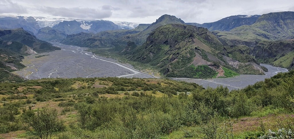
The whole area is magical. The huge moss-covered mountains will seem small next to the spectacular glaciers.
The rivers flowing through the valleys create amazing patterns, and the black river band creates a breathtaking contrast with the green landscape.
Choose one of the trails and climb the surrounding peaks to enjoy the beautiful views.
How to get there
Be sure to study in advance how to visit þórsmörk in detail. To reach Thórsmörk, you need to have some driving experience and a really good 4×4 vehicle as there is a river crossing on the way. Because of that, it’s accessible only during the summer months.
You will get there following the challenging and unpaved road F249.
Another option is to use a bus that will take you there (this is the best option for people who don’t have experience with river crossing).
You should also know that the hikes start from 3 locations: Volcano Huts in Húsadalur, Langidalur Huts, and Básar Huts. All of them offer accommodations.
Best hikes in Thórsmörk
- Probably the best views of Thórsmörk Nature Reserve can be enjoyed on the summit of Mount Valahnúkur. The hike is easy, and takes about 2 hours (4,3 km). It offers a 360-degree view of the valley, the glaciers, and the mountains. Just follow the white marks.
- A more challenging and time-consuming hike starts in Volcano Huts and continues with white marks up to the foothills of the Tindfjöll mountains. After that, you’ll appreciate Thórsmörk’s landscapes. It takes around 3 hours and is a circle trail.
- Ready for some wonderful views of the cliffs and Króssa River? You can enjoy that by taking the Merkurrani Plateau Trail. Starting and finishing at Volcano Huts, it leads you up to the foothills of Valahnúkur Mountain and then onto the Merkurrani plateau. In total, it’s around 4 km so it takes less than 2 hours.
Kerlingarfjöll
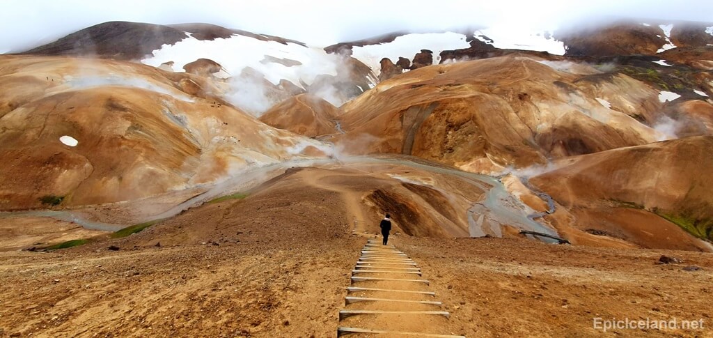
The mountains of Kerlingarfjoll remind me of the famous Rainbow Mountains in Landmannalaugar.
But because it is located in a more remote and less accessible part of the island, you won’t see the tourist crowds. Here you can be alone.
Why go
We understand why everyone is so excited about Landmannalaugar. The landscapes are just amazing. In Kerlingarfjöll, you can have similar ones but with fewer people.
You can choose from many trails showing you a breathtaking bare landscape without a hint of vegetation but with hundreds and thousands of small winding valleys, ravines, and hills coloured yellow to red.
How to get there
The area is only accessible by 4×4 off-road vehicles and only during summer months.
Take the road F35, which runs across Iceland from south to north, and turn off at a signposted junction onto the even smaller road F347. This takes you to the hotel resort and base for hiking.
Best hikes in Kerlingarfjöll
- A 2-hour-and-30-minute round trip is needed to hike to the highlight of Kerlingarfjöll to the steamy geothermal area of Hveradalir. If you want to explore the area more, you’ll need an extra 1 to 2 hours.
- About 1,5 km from the resort lies Kerlingarfjöll Hot Spring. It’s a simple and well-marked trail. We don’t consider it a hike, it’s more like a reward after the hiking day.
- You can also hike the highest mountain in the area, Snaekollur. The 7-km round trail starts at Keis car park and is quite steep and tough. In some spots, you have to pass glacial ice so it’s recommended for experienced hikers. As the snow usually covers the summit, we also recommend doing this hike during the summer season (so you don’t lose the path).
Hot river in Hveragerdi
A small city 45 km from Reykjavík, Hveragerdi is an important geothermal area and a favourite visitor destination as the popular hiking trail starts here. This one takes you to the hot river located in Reykjadalur valley.
Why go
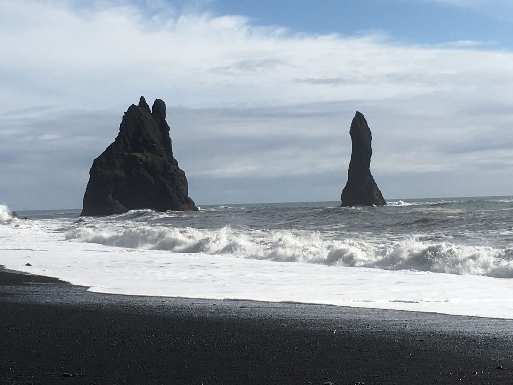
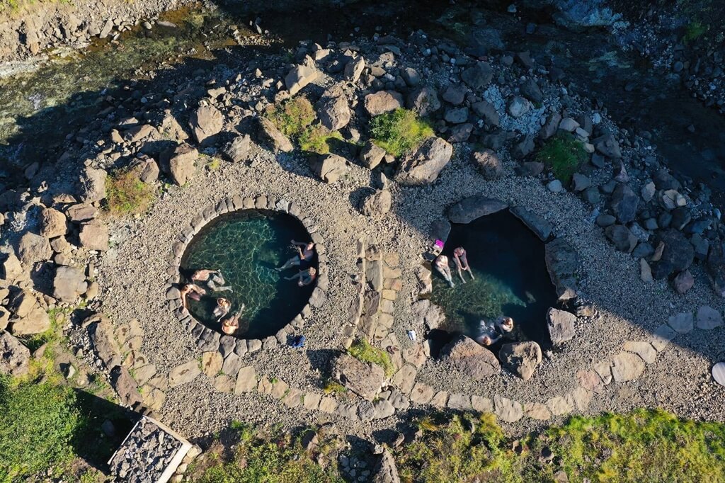
Hot River is one of the most scenic hot pots in Iceland. Its trail is lined with green hills where sheep graze happily and pass dozens of pools with boiling water and bubbling mud.
It is an easy walk that ends with the hot river where you can bathe. Can you imagine such a reward after hiking?
How to get there
As stated above, the place is less than an hour from Reykjavík, located on the Ring Road heading to Vík.
The trail starts from the parking lot, a 6-minute drive from Hveragerdi.
Tips on visiting
- You can dip into the hot river. The temperature of the river depends on the season and weather. In general, the higher you go, the warmer the water is. Make sure to pay attention to the signs, as there could be boiling water and dangerous parts.
- One way is around 3,5 km, making it a 7 km round trip. However, the trail doesn’t finish at the hot river. You can stop there and continue or make a circle and stop on the way back.
- The location and total distance make it a perfect plan for a one-day trip.
- While you can bathe in the river, the pools you encounter on your way to the river are not only boiling but can be toxic. It’s always best to take warning signs seriously and keep your distance.
Glymur
Beautiful, tall waterfall falling 198 metres into the narrow valley. It’s the second-tallest Icelandic waterfall and a popular spot for both locals and visitors.
Why go
Besides being the second tallest waterfall in Iceland, the hike to the viewpoint on the top is perfect for a one-day trip.
The trail takes you through the cave of Thvottahellir, where you need to cross the river. At the summit, you will enjoy the view not only of the waterfall itself but also of the surrounding landscapes.
How to get there
The trail to Glymur starts from the parking lot, which is a 45-minute drive from Reykjavík.
You follow Road 1 north from the capital and then turn on Road 47 just before the Hvalfjordur tunnel. The road trip is beautiful itself thanks to nice views of the fjord and surrounding landscapes.
Tips on visiting
- The hike is short, but it might be challenging for some. It is very steep, and you have to cross the river over a log with the assistance of a rope.
- The log is there only during summer, during winter you can choose the other trail which will show you the opposite side of the waterfall. In this case, you follow the trail, turn left before the river crossing and follow the trail along the river until you are on the cliff.
- The last option is to make a circuit, as the easy way is just going up and then down. This one, though, includes two river crossings. After you climb up to the waterfall, just follow the trail up and then a bit down to the river, where you cross and continue the trail back to the parking lot.
Mount Esja
Mount Esja or Esjan is situated in Kjalarnes towering up in the skyline of Reykjavík over Faxaflói Bay. It creates an iconic postcard image of the landscape.
Thanks to its location, it’s a popular destination for day hiking trips. However, it isn’t actually a mountain but a volcanic range.
Why go
If you’re staying in Reykjavík, this is a perfect place for a hike. There are multiple trails with different difficulty levels, and when the weather is nice, it offers amazing landscape views.
How to get there
To get to the trail’s starting point, which is located at Esjurætur Hiking Center, you can take a car or a bus. It’s around 30 minutes by car and 1 hour to 1,5 hours by bus. It’s located next to Road 1, past the town of Mosfellsbær, just east of Reykjavík.
Tips on visiting
- There are several different routes to and around the mountain. The trails are marked by boots indicating their difficulty (1 boot = easy, 3 boots = challenging) The most popular paths lead to the separate summits of Þverfellshorn and Kerhólakambur.
- If you want to reach the highest point, called Hábunga, you need to add another 3 km trail after reaching Þverfellshorn.
Skaftafell
Skaftafell is the second largest national park in the south of the country, it’s part of Vatnajökull National Park and has some of the best day hikes in Iceland.
Why go
It’s one of Iceland’s most popular natural attractions thanks to its many trails, hiking campsite and good transport links. However, most hikers stick to the first few hundred metres of the trail, so the more remote parts of the park are much less busy.
How to get there
Skaftafell is easily accessible from the Ring Road. The trails usually start from the visitor centre, considered an entrance to the national park. It’s around 140 km (1 hour 45 mins) far from Vík or Höfn.
Best hikes in Skaftafell
- Hike to the iconic Svartifoss waterfall. It starts at Skaftafellsstofa, the visitor centre, and continues by the Hundafoss and Magnúsarfoss waterfalls. This circle trail is 5,8 km long and requires 2 hours to finish it.
- If you want to enjoy the view of the glacier, you can walk along Jökulslóð. It takes 1 to 1,5 hours to finish, and you will admire the landscapes shaped by the glacier.
For more experienced hikers, there is a trail to Sjónarnípa. During this 6,5 km walk, you can enjoy the views of Hrútfjallstindar and Kristínartindar mountains and the Öræfajökul.
Later on, the view of the magnificent Skaftafellsjökull opens. It is a circle route and usually takes 2 hours to finish it.
What are your thoughts on the best day hikes in Iceland?
Check out these handy reference manuals if you want to learn more about the best day hikes in Iceland.

BTW, if you are getting ready for your trip, make sure to take advantage of these useful, money-saving links to book your trip:
- Research and book your flight with Skyscanner. I have found them to be the best because they list all airlines including the budget ones. You are always sure of having researched all options.
- For car rental around the world, Discover Cars has flexible pickup and drop-off options, I recommend Discover Cars.
- Book your accommodation with Booking.com. I find they have a wide selection and a nice, user-friendly, transparent website.
- Protect your trip and, more importantly, protect yourself with travel insurance. I use Travelinsurance.com and have been very happy with them.
- For more general tours to any destination or attraction, book with Viator. Check them out.
- Need a visa? Get your visa for all countries with Passport Visa Express.
- Looking for a cool walking tour to explore a city? My favorite walking tours are offered by Take Walks.
- Food and drink tours are the best way to enjoy a city. And Devour Tours are my favorite.
- Looking for a good VPN to protect your security, privacy and freedom online while traveling? Nordvpn is your best option.
- The best and most economical way to stay connected while traveling is with an Airalo eSIM.
I personally use, and can recommend, all the companies listed here and elsewhere on my blog. By booking through these sites, the small commission we earn – at no cost to you – helps us maintain this site so we can continue to offer our readers valuable travel tips and advice.


